Desert Ridge Monument Sign

DRCA Landscape Maintenance Maps

The Desert Ridge Community Association Landscape Maintenance Maps below represents the common areas that are maintained by the Master Association. Each map has a legend showing the common area and corresponding week during the eight (8) week landscape maintenance rotation in which that specific common area location is scheduled for maintenance.

Map #1

Maintenance boundaries that are along the east side of 40th Street to westside of Tatum Boulevard and southside of Pinnacle Peak Road to northside of Deer Valley Drive.
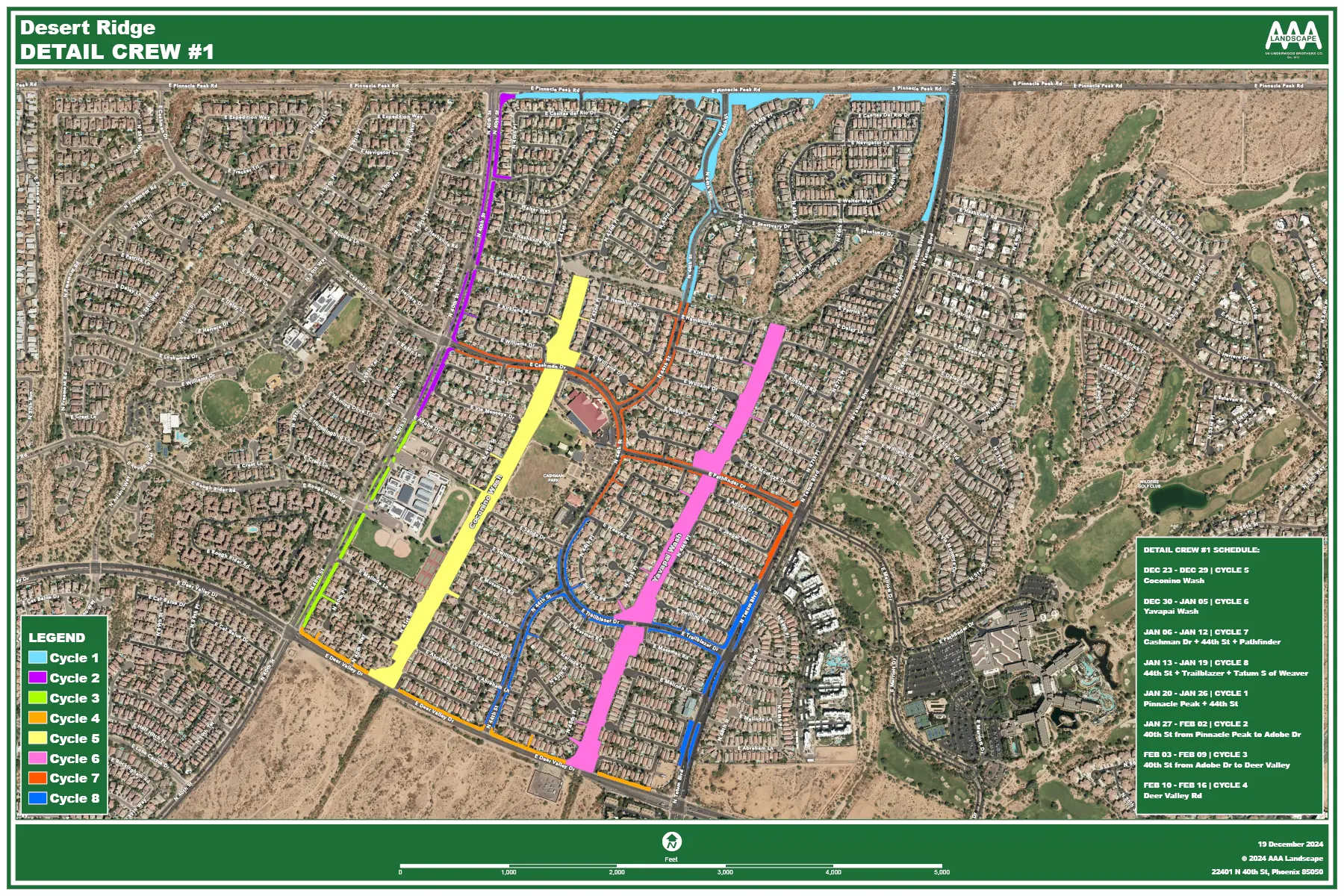
Desert Ridge Landscaping Map 1
Note: The landscape common areas for Fiesta, Cielo and Sanctuary sub-associations are not the maintenance responsibility of the master association. Please click here to locate and your sub-association community manager contact info to report a landscape maintenance concern/issue.

Map #2

Maintenance boundaries that are along the eastside of Tatum Boulevard to the eastside of 56th Street and northside of Ranger Road to the northside of Deer Valley Drive.
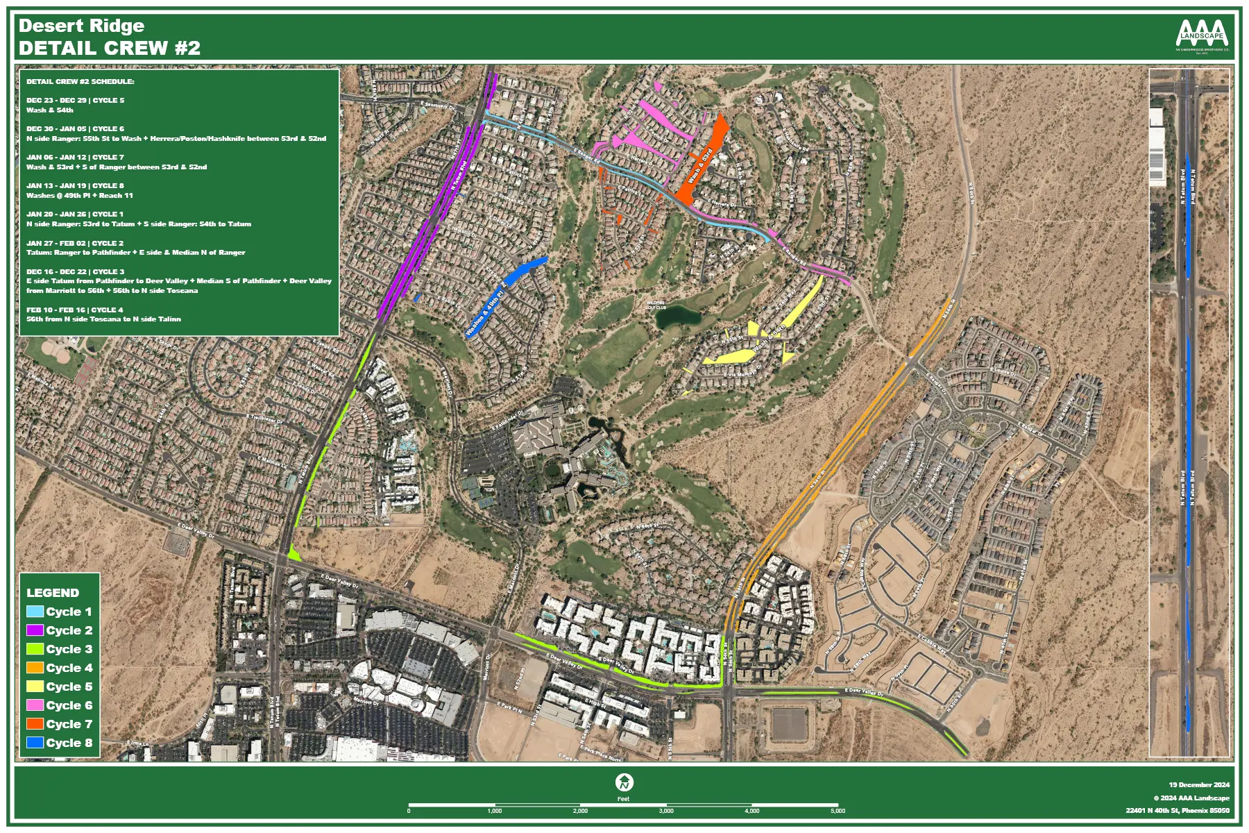
Desert Ridge Landscaping Map 2
Note: The landscape common areas for Glen Eagle, Ironwood Greens, Expedition Point, Lockwood Estates, Leroux Springs, Bella Monte and Toscana sub-associations are not the maintenance responsibility of the master association. Please click here to locate and your sub-association community manager contact info to report a landscape maintenance concern/issue.

Map #3

Maintenance boundaries depicted are north from the Deer Valley Drive medians to south of Mayo Boulevard, and west from the 40th Street medians to the Black Mountain Boulevard medians.
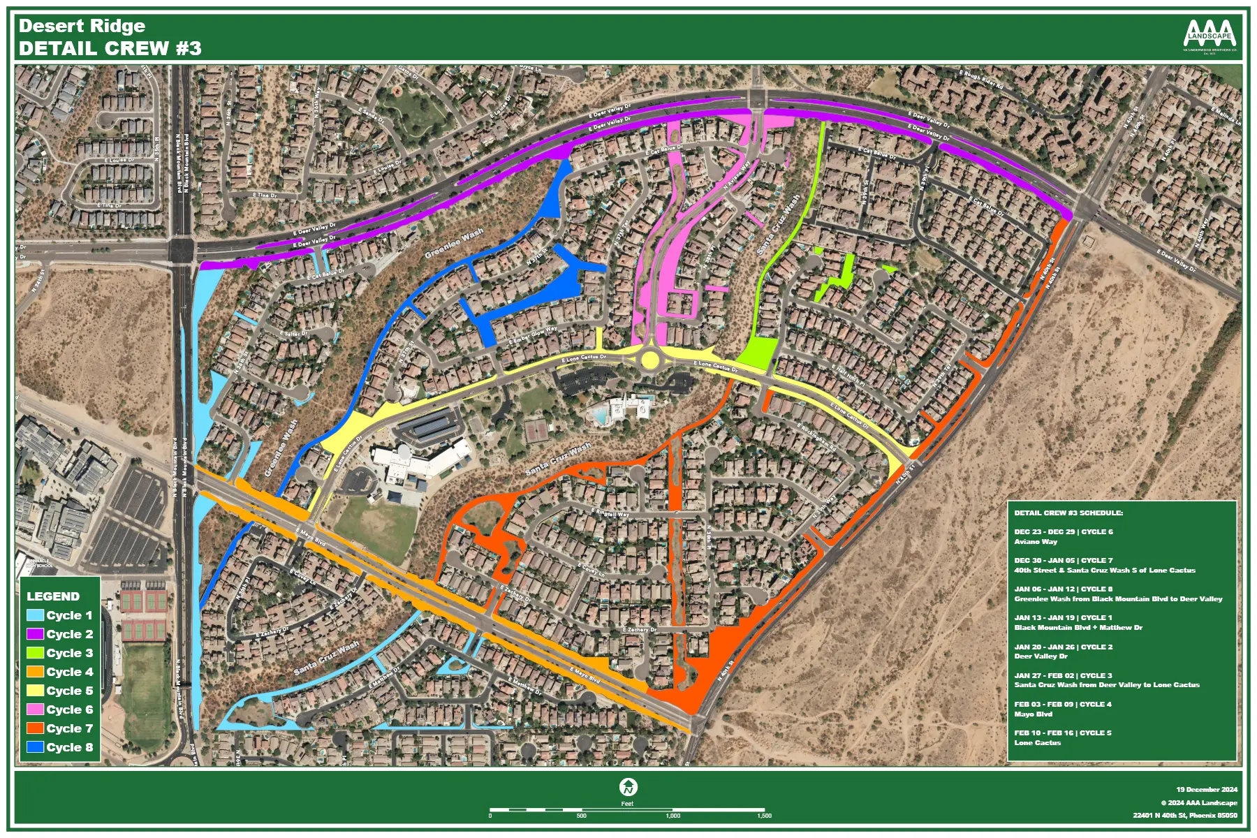
Desert Ridge Landscaping Map 3
Note: The landscape common areas for Aviano, Villages at Aviano and Fireside sub-associations (including their gated/benefited neighborhoods) are not the maintenance responsibility of the master association. Please click here to locate and your sub-association community manager contact info to report a landscape maintenance concern/issue.